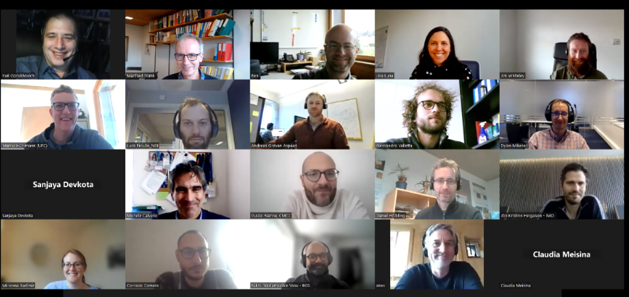
On Wednesday 22nd February 2023, LandAware members participated to the Global FOREWARN Community meeting, with a special focus on landslides.
Here are the meeting minutes
Below the full recording of the meeting:
On Wednesday 22nd February 2023, LandAware members participated to the Global FOREWARN Community meeting, with a special focus on landslides.
Here are the meeting minutes
Below the full recording of the meeting:
NEWS received from
Luca Piciullo (NGI, Norway)
Joint Technical Workshop (WG8 & ISSMGE TC309) on Landslide Warning and Prediction using IoT and Machine Learning
February 23, 2023 09:00-12:00 CET
Teams Meeting ID: 331 710 067 783 – Passcode: V6tSh9
NEWS received from
Manfred Stähli (WSL, Switzerland) and Ben Mirus (USGS, USA)
On February 3, 2023, a meeting of LandAware WG 5 “Innovations” addressed the role of wind speed and direction for landslide occurrence in Hurricane prone regions.
Guest speaker, Yuri Gorokhovich (Lehman College, City University of New York) illustrated how we are getting closer to predicting landslides in Hurricane prone regions in real-time using wind information.
The recorded presentation is available in the LandAware youtube channel
The next WG 5 meeting – with a completely different topic – will take place in May/June 2023.
Manfred Stähli & Ben Mirus
NEWS received from
Davide Tiranti (Department of Natural and Environmental Risks, Regional Agency for Environmental Protection of Piemonte – ARPA Piemonte, Italy)
A new Special Issue entitled “Geomorphological Mapping Research for Landslide” in the GeoHazards journal (MDPI) is currently open for contributions. The Special Issue is guest edited by Davide Tiranti.
https://www.mdpi.com/journal/geohazards/special_issues/RU4KF6FCE3
Without a thorough knowledge of the landslides’ distribution on the territory you cannot lay the basis for developing a LEWS. The mapping of landslides is the first fundamental step through which it is possible to establish the relationships between landslides and the territorial and climatic variables responsible for their triggering and evolution.
The purpose of this Special Issue is to collect scientific works aimed at mapping landslides and the applications that derive from them, such as the production of inventory maps, susceptibility maps, hazard/risk maps, urban planning, and the development of tools in a GIS environment aimed at collecting, processing, analysis, visualization and dissemination of landslide data.
If you are interested in submitting your manuscripts to the SI, but your institution does not fund the open access publication, please contact Davide Tiranti to get a 100% APC discount (a maximum of 10 discounts are available).
NEWS received from
Hiroaki Nakaya (NILIM-MLIT, Japan) and Graziella Devoli (NVE, Norway)
LandAware Working Group 1 releases its first/initial version of glossary and catalog as a result of its activities for the first two years.
These are tentative in their nature, but more than merely passing, collaborative efforts of related associates and observers of the WG during the Pandemic of COVID 19.
The outline was briefly discussed in the Workshop held in October 2022 in Zurich, and additional explanation is to be made in the Interpraevent in Taiwan, postponed until next April, 2023.
It is hoped that members of the LandAware, together with other professional communities, refer to the common terminology enlisted in the glossary and to the Catalog, which definitely needs periodic update, to facilitate communication both internally within the community and externally with-out for extensional purpose.
The catalog and the glossary can be reached though this link https://www.landaware.org/glossary-and-catalog-of-lews/
They are open; and citation is to be made as “LandAware Working Group 1 Catalog, 2022.”
With much appreciation,
Chair Hiroaki NAKAYA of Japanese NILIM-MLIT and Co-Chair Graziella Devoli of Norwegian NVE.
The first General Assembly (GA) of the LandAware network was held online on Friday, December 2, 2022.
After a brief recounting of the genesis of LandAware and its first two years of activities, the GA discussed the reorganization proposal made by the Executive Committee (EC), particularly regarding the working groups (WGs).
The proposal unanimously voted by the GA participating members is the following:
NEWS received from
Manfred Stähli (WSL, Switzerland)
We would like to draw your attention to the session 2.12. “LANDSLIDE EARLY WARNING SYSTEMS: INNOVATIONS AND APPLICATIONS” which is scheduled in the program of the 6th World Landslide Forum (Florence, Italy, 14-17 November 2023).
The session is open to contributions from researchers, agencies, decision-makers and practitioners and intends to cover every topic connected with LEWS, at every scale: methodological innovations, technical advances, operational implementations, reliability evaluation, documentation of case studies, communication strategies, social perception of warnings and management of uncertainties.
You can read the complete description of the session here, and submit your abstract at https://wlf6.org/submission/. Please take note that the abstract submission deadline is set to 28 February 2023.
We wait for your contribution and we hope to see many LandAware colleagues in Florence next year!
Samuele Segoni, Manfred Stähli, Neelima Satyam, Annette Patton, Luca Piciullo and Graziella Devoli
The summary report of the LandAware Workshop 2022 is now available on the page: https://www.landaware.org/workshop2022/
The recordings of the Workshop are available on our youtube channel: https://www.youtube.com/@LandAware
NEWS received from
Luca Piciullo (NGI Norway)
—–
Third Workshop on How to use IoT data in landslide modelling for the IoT-based methods and analyses Working group
December 1 – 16:00 – 17:30 CET time
Agenda
16:00-16:15 Dylan Mikesell (NGI, Norway) – Timeline and planned activities
16:15-16:30 Ben Mirus (USGS, USA) – Overview of USGS monitoring, modeling, and other research strategies for real-time situational awareness and landside warning
16:30-16:45 Luca Piciullo (NGI, Norway) – A first step towards a IoT-based local early warning system for an unsaturated slope in Norway
16:45-17:00 Roberto Greco (University of Campania, Italy) – Identification of Hydrological Controls for Improvement of Shallow Landslide Prediction in Pyroclastic Slopes of Campania
17:00 Discussion
Ben Mirus is a Research Geologist with the U.S. Geological Survey’s Landslide Hazards Program in Golden, Colorado. Ben applies his background in geology, hillslope hydrology, and numerical modeling towards developing new tools for landslide hazard assessment and loss reduction.
Luca Piciullo PhD at the University of Salerno, Italy, in Geotechnical engineering. Currently employed at the Norwegian Geotechnical Institute (NGI), Oslo, Natural Hazards division, in the section Slope stability and risk assessment. The technical and scientific work focuses on slope stability analysis, monitoring and risk mitigation with early warning systems, risk assessment of building damages due to deep excavations and tailings dams stability analysis.
Roberto Greco, Ph.D. in Hydraulic Engineering at Università di Napoli “Federico II” in 1997, professor of Hydrology and Hydraulic Infrastructures at Università della Campania “L. Vanvitelli”, teaching in the M.Sc. courses in Civil and Environmental Engineering. Since 2016, member of the Editorial Board of Hydrology and Earth System Sciences. The research activity deals with monitoring and modelling of water in natural and artificial systems, with specific focus on hillslope hydrology and landslides; preferential flows in unsaturated soils; environmental impact of sewer systems; management of water supply networks.